Showing posts with label Map. Show all posts

Monday, May 24, 2010

Map Woes Part 4

(...continued from Map Woes Part 3)

A recent visit to the Survey of India map sales office in Delhi was most frustrating. The people there were extremely reluctant to show me any maps without me first telling them the exact sheet number- they probably even need the latitude and longitude- and even then could only give me some large but pretty useless trekking maps of the Gangotri, Badrinath, and Shimla hills regions.

Pic: The impressive looking but ultimately disappointing trekking map from SOI (Bibek Bhattacharya)

They were careworn and mothballed, and the contour maps were kept firmly out of sight. I had made the mistake of going there without the sheet names and they effectively used it against me. And of course there’s that eternal suspicion. Just who is this person, they think. Why does he want topographical maps of border areas?

I had to settle for the trekking maps. Next time I go, I’ll take a sheet of paper with ALL the sheet names I can think of, and then some. And this time, if they demur, I will HAVE to do the unethical thing and wave my press card at them!

But then, a few weeks ago, I found this! I’d heard of it before, but I had no clue that it was freely available.

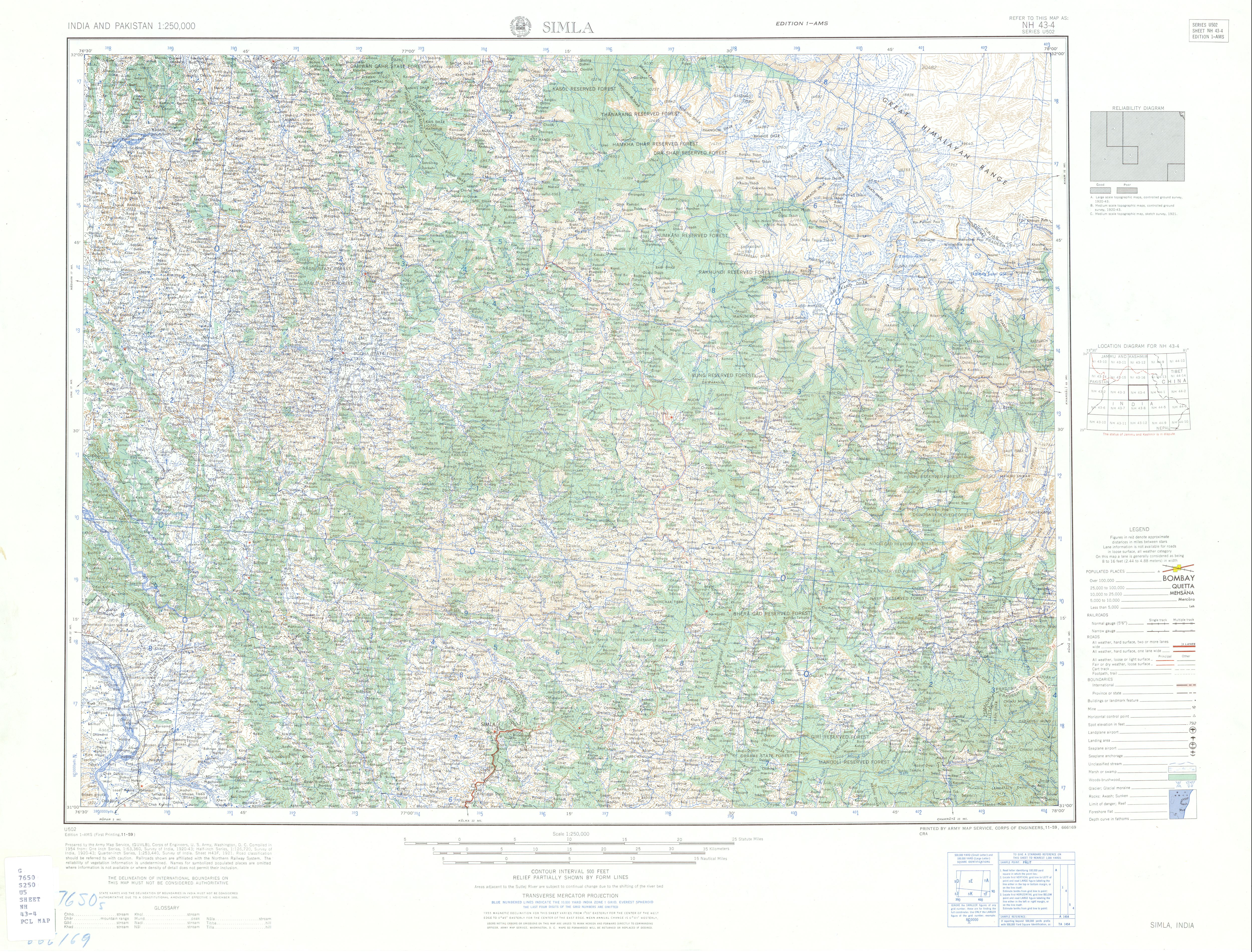
These amazingly detailed topographical maps are the legendary Series U502, made by the US Army Map Service for, yes the US Army, back in 1955. That makes them 55 years old, but boy are they out of this world. These sheets are the real thing- at least in the absence of SOI sheets. And the sheer scope of it is massive too, covering the entire subcontinent, including India, Pakistan, East Pakistan- ah the period piece ring of that- and Ceylon.

From what little of this vast map I’ve seen, most of the Himalayan regions seem to be pretty accurately mapped, at least after checking them against the others. And I can’t begin to describe the joys of learning the names of the many unforgettable places that I’ve seen in the mountains, and all that I’m yet to see. Entire ridge systems, rivers, towns have their names. Now these names might have gone out of use since all those years ago, but many of these I’ve managed to verify. The trend seems to be that of pretty accurate nomenclature.

Pic: The Dehradun Sheet of the AMS Series U502 (Bibek Bhattacharya)

The maps trip up in some places. For example, in the 'Simla' (sic) sheet, there’s a blank spot beyond the Pin Parvati pass where Spiti should be. It could be that the region had not been surveyed at the time. Then there are problems with the deeply contentious Indo-Chinese international border north of Gangotri. According to these maps, the entire Mana Gad (Gad is Garhwali for river) valley and its tributaries belong to China, although a glance through Kapadia’s Across Peaks and Passes in Garhwal gives us the real picture. At the end of the day there is no substitute for actually visiting these places.


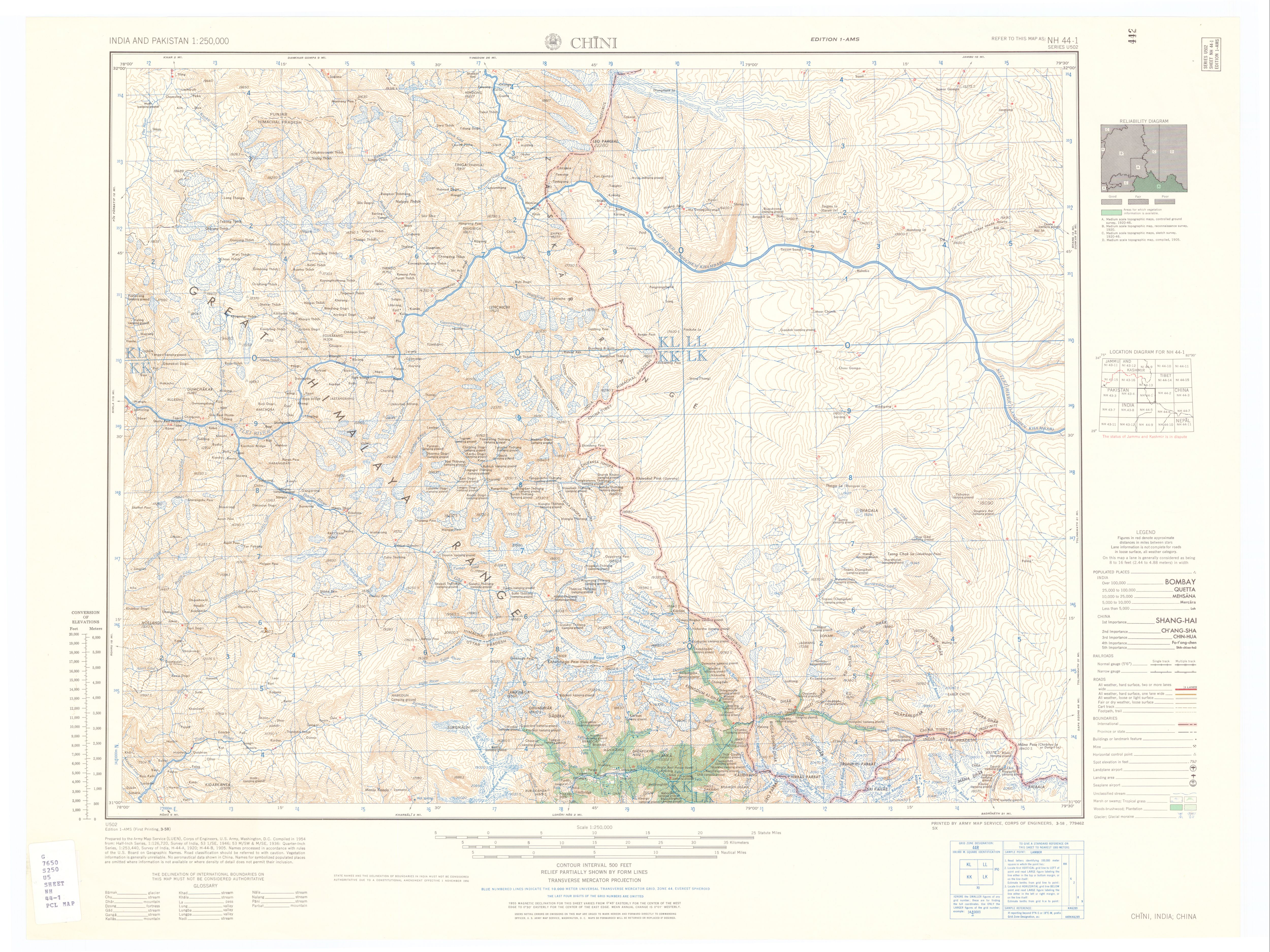
Pic: Compare the section of the Chini sheet with Kapadia's map for the Mana Gad area in upper Central Garhwal. (Bibek Bhattacharya)

However, it must be said that where unsure, the Series U502 mentions it. They even have a handy 'Reliability Diagram' to the right of the map, where they rate the available information in that particular sheet from 'Good' to 'Fair' to 'Poor', and even list out the dates when the ground was surveyed. The oldest survey on the 'Chini' sheet, for example, are Medium Scale Topographical Maps from 1905!

Anyway, I’m completely in love. Oh, and finally, to end where I began, I now know the names of the eminences you see when you stand atop Chandrashila on a clear October day. It might be a meager victory, but to me that’s momentous!

And so, my map woes are at an end- at least until I renew the saga of SOI Topographical maps.


IndiBlogger - The Indian Blogger Community

Map Woes Part 3

(...continued from Map Woes Part 2)

So anyway, I went to McLeodganj shortly after that year, and in a small bookshop near the Dalai Lama’s monastery, I found two sheets of the Leomann Map series, these ones dealing with two of Himachal Pradesh’s regions. I was dumbstruck by their detail. There were clear ridge-lines and marked glaciers, all possible landmarks and trails, as well as most of the peaks en route. Leomann maps are, so far, the most comprehensive all-in-one set of maps of the Himalaya that I’ve come across.

Pic: Leomann Maps Sheet 4 (Bibek Bhattacharya)

After such knowledge, what forgiveness?

However, in the year and half since then, I’ve scoured bookshops and chat groups wherever I can and haven’t come across any other Leomann map. To get the full set, the only recourse to order the lot online, which I can't afford, especially with the shipping costs.

Over the past year, I’d amassed quite a few books on trekking trails, which included two quite good ones- Trekking Guide to the Western Himalaya by Depi Chaudhry and the legendary Harish Kapadia’s Trekking and Climbing in the Indian Himalaya. Both have excellent maps, although Kapadia’s book shades it, purely because he’s been all over the place and knows the terrain like the back of his hand.

This year I discovered Flipkart, and thanks to their wonderfully no-nonsense attitude to online book shopping, I was soon drowning in mountain books- and maps. The combined heft of Kapadia’s Across Peaks and Passes Garhwal Himalaya, Kumaon Himalaya and High Himalaya Unknown Valleys added some remarkable maps to my collection. Sadly, his books are horribly edited, but even bad editing can’t dampen Kapadia’s enthusiasm for the range, nor negate the sheer amount of distance that he has covered in his forty years of mountaineering. His maps are among the best I’ve seen so far. They tell you everything you need to know, and there are never any gaps in the information. They have detailed ridge lines, rivers, prominent landmarks, watershed ridges and are almost exhaustive in naming peaks in the regions.

Pic: Harish Kapadia's remarkably detailed maps (Bibek Bhattacharya)

As an aside, anyone interested to get their hands on some good writing on the range should get a hold of Bill Aitken's The Nanda Devi Affair and Footloose in the Himalaya. Both are, again, the victims of horrid editing, but Aitken's a particularly fine writer, and his passion for the range, coupled with his acute observations and charming eccentricity, make both books a must read.

Thanks to Kapadia's exhaustive maps, here was something that I could use in tandem with Google Earth to get a visual sense of the terrain in every Himalayan region. The joys were many, from charting out all possible peaks in central Garhwal- and thus solving the many mysteries of the view from Tunganath- to tracing out the more challenging trekking routes, like that from Chitkul in the Baspa valley over the Himalayan divide between Himachal and Garhwal over the glaciated Lamkhaga Pass to Harsil near Gangotri.

But proper contour maps still eluded me.

(to be concluded)

IndiBlogger - The Indian Blogger Community

Monday, May 17, 2010

Map Woes Part 2

(...continued from Map Woes Part 1)

So I looked for other maps. Some of these I found in books, and the information I tried to locate with the help of GE as well as Wikimapia (which is better marked but not always trustworthy). It’s a painstakingly slow process, but at least I was making progress.

The Eric Shipton Anthology possessed his superlative book Nanda Devi, which had a reasonably good map (which was great to get my bearings) of the Nanda Devi-Bhyundar- Joshimath-Badrinath-Madhmaheshwar area; basically central Garhwal.

Pic: Central Garhwal Himalaya from Shipton's Nanda Devi (Bibek Bhattacharya)

An infinitely better plotted set of maps soon emerged out of mountaineer and photographer Kekoo Naoroji’s book of photo essays Himalayan Vignettes. It also had a very good set of maps of Western Sikkim, the area around Kanchenjungha and Nepal Gap glacier. What’s more, the book also included sizable chunks of lower Garhwal.

Pic: A plate from Kekoo Naoroji's Himalayan Vignettes (Bibek Bhattacharya)

A third resource was Frank Smythe’s book Valley of Flowers. That book has some nice trail maps, especially of the classic Garhwal “approach trek” from Gwaldam to Joshimath via Kuari Pass and of his explorations around the Bhyundar Valley.

Pic: Map of the Bhyunder-Kamet region in Central Garhwal from Smythe's Valley of Flowers (Bibek Bhattacharya)

The problem with this was age. It was written in 1938- he made the journey in 1937- and that area was only in the process of being properly surveyed, so names of lesser peaks, glaciers and villages wasn’t exactly fixed. But it felt great to compare maps and accounts of these early writers- for a profoundly Indian point of view of the Uttarakhand Himalaya in that era, see Umaprasad Mukherjee's travelogues.

Pic: Map of the Gangotri Glacier region from Umaprasad Mukherjee's travelogue (Bibek Bhattacharya)

Needless to say, I was devouring all this.

But I longed to get my hands on some serious maps of the Western Himalaya. Being quite hidebound as well as anal in my pursuits, I especially looked out for maps of Uttarakhand, as this was the region I wanted to explore first.

(to be continued)

Saturday, May 15, 2010

Map Woes Part 1

Trying to find good trekking and topographical maps in India is somewhat like the proverbial head meeting the proverbial wall. My year of looking for the perfect set of maps- primarily of the Indian Himalaya, but also of other places- has yielded very interesting results.

I love travelogues, especially those dealing with mountains, specifically the Himalaya. Now due to the range's monumental hold on generations of visitors, there’s no short supply of great books or essays on this subject. But for an obsessive like me, what’s the fun in reading about these grand places without a good map to locate them on?

The most commonly available maps of Uttarakhand and Himachal are the Nest and Wings maps, which are a combination of various sources, including the Survey of India trekking and topographical maps, and others. Now, these are generally quite good, with towns, cities, villages, passes, roads, lakes, trails etc mentioned in impressive detail. For the longest time, they were enough for my needs.

Pic: A section of the Nest&Wings map of Uttarakhand

But with a deepening interest came the urge to collect better maps, which would chart out valley systems, topographical features, ridge lines, peaks and approaches better. Now, this isn’t an unfair thing to expect. Look up any mountainous region in the world where travelers are wont to venture, and you’ll find some excellent trekking maps- not the meagre ones that our government issues, but more on that later.

My search began in earnest last summer, after a visit to Tunganath and Chandrashila in the high Garhwal Himalaya, a place with views that make you want to sink to your knees and weep with rapture. Faced with the dramatic panorama of the Himalayan crest on the northern horizon, and the lower hills and then the plains far away, I was burning to lend nomenclature to all that I was seeing. Thanks to Nest and Wings, I had a general idea of the regions I was looking at- e.g. I could trace roughly the line from Bedni bugiyal via the high distant ridge of Kuari Pass in the west and below it, the deep cleft of the Alaknanda gorge. Where mid-day clouds covered the horizon, I expected the western arm of the Great Himalaya, containing the likes of Trishul, Nanda Devi, Dunagiri, Hathi Parbat, Ghori Parbat and Kamet, to name a few.

Pic: Nanda Devi looking west from Chandrashila (Bibek Bhattacharya)

In front of me, just beyond the end of the ridge running north from where I was, the cairn strewn summit of Chandrashila, loomed Chaukhamba. It is also known as Badrinath, after the Dham, and these four pillars of snow, ice and granite held sway over the imagination of Garhwal.

Pic: Chaukhamba looking north from Chandrashila (Bibek Bhattacharya)

On its northern face it formed a cirque of peaks at whose feet arose the Gangotri glacier. Further north west ran the line of the southern faces of a host of well known peaks that cluster around the Gangotri Glacier.

It was impossible, however, to be sure of the names of the peaks- apart from those of Kedarnath and Chaukhamba- at least for me. Having recently discovered Google Earth, however, I was hopeful of finding out the names.

Pic: An overhead screenshot of Uttarakhand Himalaya

Google Earth was quite brilliant, visualizing the peaks for me, but they weren’t named, at least the vast majority weren’t. In this case, Nest and Wings was useless.

(to be continued)

IndiBlogger - The Indian Blogger Community